
Tập tin:Sea Gate aerial view.jpg
Kích thước hình xem trước: 800×534 điểm ảnh. Độ phân giải khác: 320×214 điểm ảnh | 640×428 điểm ảnh | 1.024×684 điểm ảnh | 1.500×1.002 điểm ảnh.
Tập tin gốc (1.500×1.002 điểm ảnh, kích thước tập tin: 657 kB, kiểu MIME: image/jpeg)
Tập tin này từ Wikimedia Commons. Trang miêu tả nó ở đấy được sao chép dưới đây. Commons là kho lưu trữ tập tin phương tiện có giấy phép tự do. Bạn có thể tham gia. |
| Miêu tả |
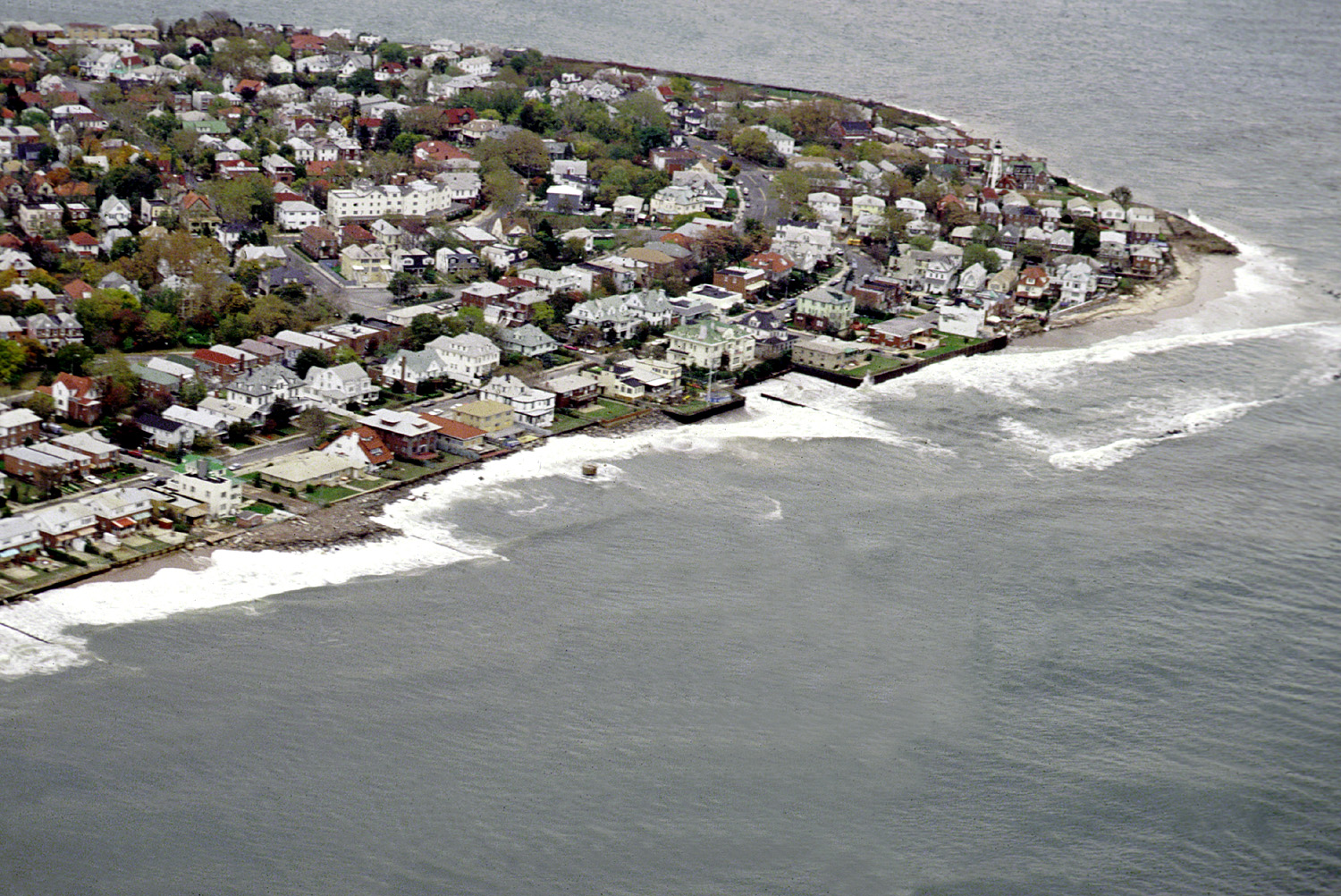
English: Aerial view of the Sea Gate community located on the westernmost extremity of Coney Island, Brooklyn, New York City. |
|||
| Ngày | ||||
| Nguồn gốc |
U.S. Army Corps of Engineers Digital Visual Library Image page Image description page Digital Visual Library home page |
|||
| Tác giả | U.S. Army Corps of Engineers, photographer not specified or unknown | |||
| Giấy phép (Dùng lại tập tin) |
|
|||
| Vị trí | Brooklyn, New York City, New York, USA |
| Vị trí đối tượng | | Xem hình này và các hình ảnh lân cận trên: OpenStreetMap |
|---|
Lịch sử tập tin
Nhấn vào ngày/giờ để xem nội dung tập tin tại thời điểm đó.
| Ngày/giờ | Hình xem trước | Kích cỡ | Thành viên | Miêu tả | |
|---|---|---|---|---|---|
| hiện tại | 05:01, ngày 9 tháng 4 năm 2007 | | 1.500×1.002 (657 kB) | DanMS | {{Information | Description = {{en|Aerial view of the Sea Gate community located on the westernmost extremity of Coney Island, Brooklyn, New York City.}} | Source = U.S. Army Corps of Engineers Digital Visual Library<br />[http://images.usace.a |
Trang sử dụng tập tin
Có 1 trang tại Wikipedia tiếng Việt có liên kết đến tập tin (không hiển thị trang ở các dự án khác):
Sử dụng tập tin toàn cục
Những wiki sau đang sử dụng tập tin này:
- Trang sử dụng tại de.wikipedia.org
- Trang sử dụng tại en.wikipedia.org
- Trang sử dụng tại es.wikipedia.org
- Trang sử dụng tại et.wikipedia.org
- Trang sử dụng tại he.wikipedia.org
- Trang sử dụng tại ja.wikipedia.org
- Trang sử dụng tại pt.wikipedia.org
- Trang sử dụng tại sv.wikipedia.org
- Trang sử dụng tại www.wikidata.org
- Trang sử dụng tại yi.wikipedia.org