
Tập tin:FrancoPrussianWar5to6Aug1870.jpg
Tập tin gốc (1.083×928 điểm ảnh, kích thước tập tin: 1,15 MB, kiểu MIME: image/jpeg)
Tập tin này từ Wikimedia Commons. Trang miêu tả nó ở đấy được sao chép dưới đây. Commons là kho lưu trữ tập tin phương tiện có giấy phép tự do. Bạn có thể tham gia. |
Miêu tả
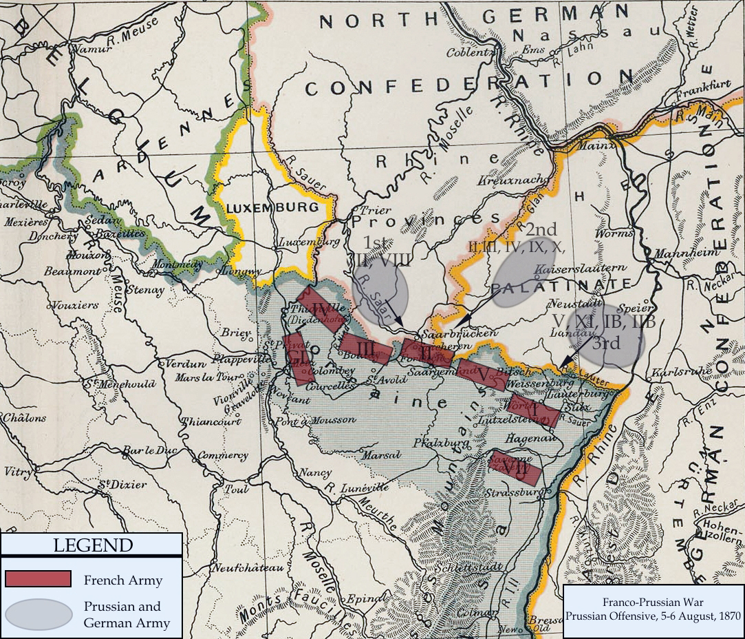
| Miêu tả | Franco-Prussian War map of 1870 | |||||
| Ngày | ||||||
| Nguồn gốc | Cambridge Modern History Atlas | |||||
| Tác giả | Edited by A.W.Ward, G.W.Prothero, and Stanley Leathes | |||||
| Giấy phép (Dùng lại tập tin) |
|

I adapted the map to reflect the state of French and Prussian/German armies from 5 to 6 August, 1870. Information for the armies was obtained from Wawro, Geoffrey (2003) The Franco-Prussian War: The German Conquest of France in 1870-1871, Cambridge University Press ISBN: 0-521-58436-1.
Lịch sử tập tin
Nhấn vào ngày/giờ để xem nội dung tập tin tại thời điểm đó.
| Ngày/giờ | Hình xem trước | Kích cỡ | Thành viên | Miêu tả | |
|---|---|---|---|---|---|
| hiện tại | 20:13, ngày 15 tháng 2 năm 2011 | | 1.083×928 (1,15 MB) | DIREKTOR | Repairs |
| 20:57, ngày 3 tháng 1 năm 2008 |  | 1.083×928 (1,04 MB) | Monsieurdl | == Summary == {{Information |Description=Franco-Prussian War map of 1870 |Source=Cambridge Modern History Atlas |Date=1912 |Author=Edited by A.W.Ward, G.W.Prothero, and Stanley Leathes }} I adapted the map to reflect the state of French and Prussian/Germ |
Trang sử dụng tập tin
Sử dụng tập tin toàn cục
Những wiki sau đang sử dụng tập tin này:
- Trang sử dụng tại azb.wikipedia.org
- Trang sử dụng tại bg.wikipedia.org
- Trang sử dụng tại ca.wikipedia.org
- Trang sử dụng tại en.wikipedia.org
- Trang sử dụng tại hu.wikipedia.org
- Trang sử dụng tại hy.wikipedia.org
- Trang sử dụng tại ja.wikipedia.org
- Trang sử dụng tại tr.wikipedia.org