
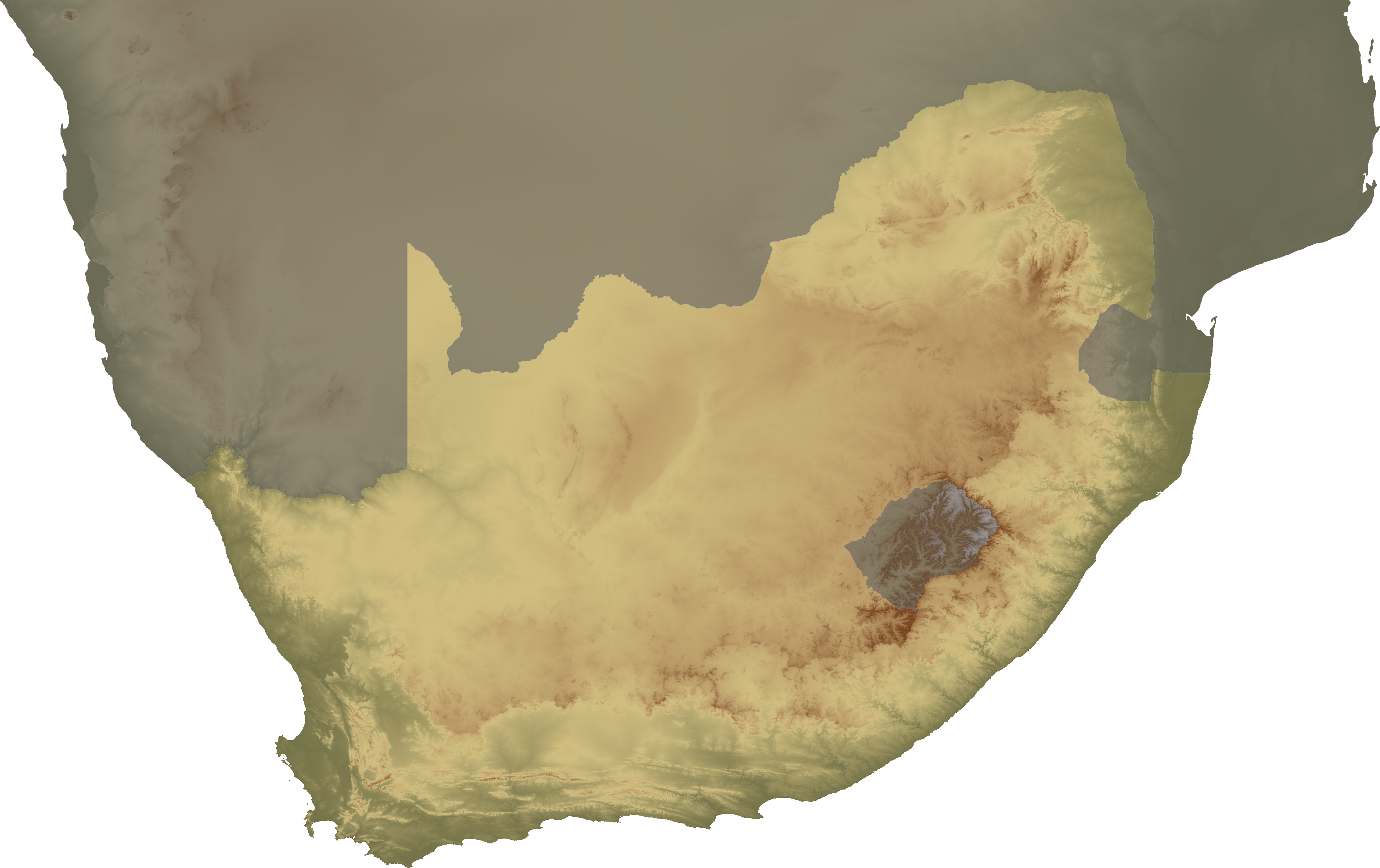
Tập tin:South Africa topo continent.png
Kích thước hình xem trước: 800×503 điểm ảnh. Độ phân giải khác: 320×201 điểm ảnh | 640×403 điểm ảnh | 1.024×644 điểm ảnh | 1.280×805 điểm ảnh | 2.560×1.610 điểm ảnh | 3.658×2.301 điểm ảnh.
Tập tin gốc (3.658×2.301 điểm ảnh, kích thước tập tin: 3,84 MB, kiểu MIME: image/png)
Tập tin này từ Wikimedia Commons. Trang miêu tả nó ở đấy được sao chép dưới đây. Commons là kho lưu trữ tập tin phương tiện có giấy phép tự do. Bạn có thể tham gia. |
| Miêu tả | Topographical map of South Africa, continent version |
| Ngày | |
| Nguồn gốc | Tác phẩm được tạo bởi người tải lên |
| Tác giả | SFC9394 |
| Giấy phép (Dùng lại tập tin) |
Topo data from SRTM, NASA PD |
| Phiên bản khác | Image:South Africa topo island.png |
Tập tin này được phát hành theo Giấy phép Creative Commons Ghi công 2.5 Chung.
- Bạn được phép:
- chia sẻ – sao chép, phân phối và chuyển giao tác phẩm
- pha trộn – để chuyển thể tác phẩm
- Theo các điều kiện sau:
- ghi công – Bạn phải ghi lại tác giả và nguồn, liên kết đến giấy phép, và các thay đổi đã được thực hiện, nếu có. Bạn có thể làm các điều trên bằng bất kỳ cách hợp lý nào, miễn sao không ám chỉ rằng người cho giấy phép ủng hộ bạn hay việc sử dụng của bạn.
Lịch sử tập tin
Nhấn vào ngày/giờ để xem nội dung tập tin tại thời điểm đó.
| Ngày/giờ | Hình xem trước | Kích cỡ | Thành viên | Miêu tả | |
|---|---|---|---|---|---|
| hiện tại | 20:00, ngày 2 tháng 2 năm 2008 | | 3.658×2.301 (3,84 MB) | SFC9394 | {{Information |Description= Topographical map of South Africa, continent version |Source=self-made |Date=02-02-08 |Author= SFC9394 |Permission=Topo data from SRTM, NASA PD |other_versions=Image:South Africa topo island.png }} {{CC-BY- |
Trang sử dụng tập tin
Có 2 trang tại Wikipedia tiếng Việt có liên kết đến tập tin (không hiển thị trang ở các dự án khác):
Sử dụng tập tin toàn cục
Những wiki sau đang sử dụng tập tin này:
- Trang sử dụng tại ar.wikipedia.org
- Trang sử dụng tại bn.wikipedia.org
- Trang sử dụng tại en.wikipedia.org
- Cape Colony
- Union of South Africa
- History of South Africa
- Bophuthatswana
- Transkei
- Kingdom of Mutapa
- Stellaland
- Ciskei
- Venda
- Potchefstroom
- Natalia Republic
- Griqualand West
- Griqualand East
- Ndwandwe
- Lydenburg
- Utrecht, South Africa
- Winburg
- Griekwastad
- Swellendam
- Klein Vrystaat
- Nieuwe Republiek
- Mthethwa Clan
- Template:Historical states of South Africa sidebar
- Zulu Kingdom
- Dutch Cape Colony
- State of Goshen
- Stafford Parker
- Timeline of Durban
- Timeline of Port Elizabeth
- Timeline of Pietermaritzburg
- Republic of Graaff-Reinet
- Trang sử dụng tại nl.wikipedia.org
- Trang sử dụng tại no.wikipedia.org
- Trang sử dụng tại ta.wikipedia.org
- Trang sử dụng tại tum.wikipedia.org