
Tập tin:IlesChesterfield 250m.jpg
Kích thước hình xem trước: 400×600 điểm ảnh. Độ phân giải khác: 160×240 điểm ảnh | 320×480 điểm ảnh | 1.000×1.500 điểm ảnh.
Tập tin gốc (1.000×1.500 điểm ảnh, kích thước tập tin: 95 kB, kiểu MIME: image/jpeg)
Tập tin này từ Wikimedia Commons. Trang miêu tả nó ở đấy được sao chép dưới đây. Commons là kho lưu trữ tập tin phương tiện có giấy phép tự do. Bạn có thể tham gia. |
Miêu tả
| Miêu tả |
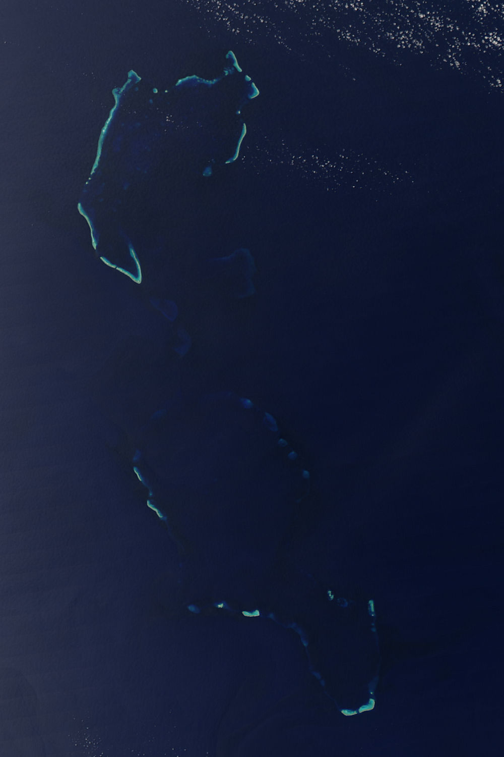
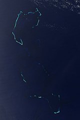
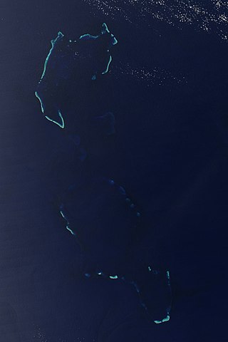
English: Îles Chesterfield/Chesterfield Reef. Credit Jacques Descloitres, MODIS Rapid Response Team, NASA/GSFC The underwater reefs around the Iles Chesterfield are easier to spot in this Moderate Resolution Imaging Spectroradiometer (MODIS) than the islands themselves. Tan slivers of land are barely visible in the image, but the underwater coral reflects light, making the ocean glow a brilliant blue. The islands are part of New Caledonia, a French territory, and are located roughly 1,000 kilometers northeast of Australia in the Coral Sea. MODIS on NASA’s Aqua satellite captured this image on October 7, 2004. |
| Ngày | |
| Nguồn gốc | https://visibleearth.nasa.gov/view.php?id=72128 |
| Tác giả | NASA |
| Phiên bản khác |
|


Giấy phép
| This file is in the public domain in the United States because it was solely created by NASA. NASA copyright policy states that "NASA material is not protected by copyright unless noted". (See Template:PD-USGov, NASA copyright policy page or JPL Image Use Policy.) | ||
 |
Warnings:
|
| Annotations | This image is annotated: View the annotations at Commons |
Lịch sử tập tin
Nhấn vào ngày/giờ để xem nội dung tập tin tại thời điểm đó.
| Ngày/giờ | Hình xem trước | Kích cỡ | Thành viên | Miêu tả | |
|---|---|---|---|---|---|
| hiện tại | 22:49, ngày 12 tháng 12 năm 2008 | | 1.000×1.500 (95 kB) | Whodidwhat | Iles Chesterfield Chesterfield Reef |
Trang sử dụng tập tin
Có 1 trang tại Wikipedia tiếng Việt có liên kết đến tập tin (không hiển thị trang ở các dự án khác):
Sử dụng tập tin toàn cục
Những wiki sau đang sử dụng tập tin này:
- Trang sử dụng tại de.wikipedia.org
- Trang sử dụng tại en.wikipedia.org
- Trang sử dụng tại et.wikipedia.org
- Trang sử dụng tại fr.wikipedia.org
- Trang sử dụng tại lt.wikipedia.org
- Trang sử dụng tại pl.wikipedia.org
- Trang sử dụng tại ru.wikipedia.org