
Tập tin:Yosemite meadows 2004-09-04.jpg

Tập tin gốc (2.250×1.500 điểm ảnh, kích thước tập tin: 1,5 MB, kiểu MIME: image/jpeg)
Tập tin này từ Wikimedia Commons. Trang miêu tả nó ở đấy được sao chép dưới đây. Commons là kho lưu trữ tập tin phương tiện có giấy phép tự do. Bạn có thể tham gia. |
| Miêu tả |
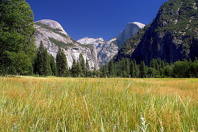
Français : Le Half Dome vu de Yosemite Meadows, les prairies humides qui couvrent le fond de la Vallée de Yosemite, dans le Parc national du même nom, en Californie (États-Unis). |
||||||
| Ngày | |||||||
| Nguồn gốc | http://pdphoto.org/ (high resolution version of an image similar to [1]) | ||||||
| Tác giả | Jon Sullivan | ||||||
| Giấy phép (Dùng lại tập tin) |
|
| Vị trí máy chụp hình | | Xem hình này và các hình ảnh lân cận trên: OpenStreetMap |
|---|
This was formerly a featured picture on Wikimedia Commons.
|
Bức hình này đã được chọn làm hình ảnh của ngày trên Wikimedia Commons vào ngày 21 tháng 3 năm 2005. Dưới đây là lời mô tả: English: Yosemite National Park, USA Các ngôn ngữ khác:
Čeština: Yosemitský národní park, USA Deutsch: Yosemite National Park, USA English: Yosemite National Park, USA Español: Parque Nacional Yosemite, EE.UU. Français : Parc national du Yosemite, USA Italiano: Yosemite National Park, USA Lëtzebuergesch: Yosemite National Park, USA Português: Parque Nacional Yosemite, EUA 中文: 美国约塞米蒂国家公园的沼泽 |
Lịch sử tập tin
Nhấn vào ngày/giờ để xem nội dung tập tin tại thời điểm đó.
| Ngày/giờ | Hình xem trước | Kích cỡ | Thành viên | Miêu tả | |
|---|---|---|---|---|---|
| hiện tại | 06:25, ngày 31 tháng 1 năm 2005 | | 2.250×1.500 (1,5 MB) | MarkSweep | Half Dome in Yosemite National Park {{PD-PDphoto.org}} |
Trang sử dụng tập tin
Sử dụng tập tin toàn cục
Những wiki sau đang sử dụng tập tin này:
- Trang sử dụng tại ca.wikipedia.org
- Trang sử dụng tại de.wikipedia.org
- Trang sử dụng tại fi.wikipedia.org
- Trang sử dụng tại fr.wikipedia.org
- Trang sử dụng tại hu.wikipedia.org
- Trang sử dụng tại ia.wikipedia.org
- Trang sử dụng tại it.wikipedia.org
- Trang sử dụng tại ja.wikipedia.org
- Trang sử dụng tại ko.wikipedia.org
- Trang sử dụng tại krc.wikipedia.org
- Trang sử dụng tại mn.wikipedia.org
- Trang sử dụng tại nl.wikipedia.org
- Trang sử dụng tại no.wikipedia.org
- Trang sử dụng tại oc.wikipedia.org
- Trang sử dụng tại pl.wikipedia.org
- Trang sử dụng tại ru.wikipedia.org
- Trang sử dụng tại ru.wikinews.org
- Trang sử dụng tại sr.wikipedia.org
- Trang sử dụng tại uk.wikipedia.org
- Trang sử dụng tại zh.wikipedia.org