Khác biệt giữa bản sửa đổi của “Balkány”
Nội dung được xóa Nội dung được thêm vào
| Dòng 1: | Dòng 1: | ||
{{Thông tin khu dân cư |
{{Thông tin khu dân cư |
||
|name |
|name = Balkány |
||
|other_name |
|other_name = |
||
|native_name |
|native_name = <!-- for cities whose native name is not in English --> |
||
|nickname |
|nickname = |
||
|settlement_type |
|settlement_type =[[Thành phố của Hungary|Thành phố]]<!--For Town or Village (Leave blank for the default City)--> |
||
|motto |
|motto = |
||
<!-- images and maps -----------> |
<!-- images and maps -----------> |
||
|image_skyline |
|image_skyline = |
||
|imagesize |
|imagesize = |
||
|image_caption |
|image_caption = |
||
|image_flag |
|image_flag = |
||
|flag_size |
|flag_size = |
||
|image_seal |
|image_seal = |
||
|seal_size |
|seal_size = |
||
|image_shield |
|image_shield = HUN Balkány COA.jpg |
||
|shield_size |
|shield_size = |
||
|image_map |
|image_map = |
||
|mapsize |
|mapsize = |
||
|map_caption |
|map_caption = |
||
|image_map1 |
|image_map1 = |
||
|mapsize1 |
|mapsize1 = |
||
<!-- Location ------------------> |
<!-- Location ------------------> |
||
|subdivision_type |
|subdivision_type = Quốc gia |
||
|subdivision_name |
|subdivision_name = {{flag|Hungary}} |
||
|subdivision_type1 = [[Hạt của Hungary|Hạt]] |
|subdivision_type1 = [[Hạt của Hungary|Hạt]] |
||
|subdivision_name1 = [[Hạt Szabolcs-Szatmár-Bereg|Szabolcs-Szatmár-Bereg]] |
|subdivision_name1 = [[Hạt Szabolcs-Szatmár-Bereg|Szabolcs-Szatmár-Bereg]] |
||
| Dòng 31: | Dòng 31: | ||
|subdivision_name3 = |
|subdivision_name3 = |
||
<!-- Politics -----------------> |
<!-- Politics -----------------> |
||
|government_footnotes |
|government_footnotes = |
||
|government_type |
|government_type = |
||
|leader_title |
|leader_title = |
||
|leader_name |
|leader_name = |
||
|established_title = <!-- Settled --> |
|established_title = <!-- Settled --> |
||
|established_date |
|established_date = |
||
<!-- Area |
<!-- Area ---------------------> |
||
|area_magnitude |
|area_magnitude = |
||
|unit_pref |
|unit_pref = <!--Enter: Imperial, if Imperial (metric) is desired--> |
||
|area_footnotes |
|area_footnotes = |
||
|area_total_km2 |
|area_total_km2 = 89,99 |
||
|area_land_km2 |
|area_land_km2 = <!--See table @ Template:Infobox Settlement for details on automatic unit conversion--> |
||
|area_metro_km2 |
|area_metro_km2 = |
||
<!-- Population |
<!-- Population -----------------------> |
||
|population_as_of |
|population_as_of =2010 |
||
|population_footnotes |
|population_footnotes = |
||
|population_note |
|population_note = |
||
|population_total |
|population_total =6362 |
||
|population_density_km2 |
|population_density_km2 =71 |
||
<!-- General information ---------------> |
<!-- General information ---------------> |
||
|timezone |
|timezone = [[Giờ chuẩn Trung Âu|CET]] |
||
|utc_offset |
|utc_offset =+1 |
||
|timezone_DST |
|timezone_DST = [[Giờ Mùa hè Trung Âu|CEST]] |
||
|utc_offset_DST |
|utc_offset_DST =+2 |
||
|latd=|latm=|lats=|latNS=N |
|latd=|latm=|lats=|latNS=N |
||
|longd=|longm=|longs=|longEW=E |
|longd=|longm=|longs=|longEW=E |
||
|elevation_footnotes |
|elevation_footnotes = <!--for references: use <ref> </ref> tags--> |
||
|elevation_m |
|elevation_m = |
||
|elevation_ft |
|elevation_ft = |
||
<!-- Area/postal codes & others --------> |
<!-- Area/postal codes & others --------> |
||
|postal_code_type |
|postal_code_type = <!-- enter ZIP code, Postcode, Post code, Postal code... --> |
||
|postal_code |
|postal_code = |
||
|area_code |
|area_code = |
||
|blank_name |
|blank_name = |
||
|blank_info |
|blank_info = |
||
|blank1_name |
|blank1_name = |
||
|blank1_info |
|blank1_info = |
||
|website |
|website = |
||
|footnotes |
|footnotes = |
||
}} |
}} |
||
Phiên bản lúc 03:44, ngày 18 tháng 8 năm 2020
| Balkány | |
|---|---|
| — Thành phố — | |
 | |
| Quốc gia | |
| Hạt | Szabolcs-Szatmár-Bereg |
| Tiểu vùng | Nagykállói |
| Diện tích | |
| • Tổng cộng | 89,99 km2 (34,75 mi2) |
| Dân số (2010) | |
| • Tổng cộng | 6.362 |
| • Mật độ | 71/km2 (180/mi2) |
| Múi giờ | CET (UTC+1) |
| • Mùa hè (DST) | CEST (UTC+2) |
| 4233 | |
| Mã điện thoại | 42 |
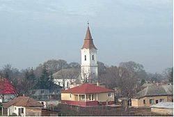
Balkány là một thành phố thuộc hạt Szabolcs-Szatmár-Bereg, Hungary. Thành phố này có diện tích 89,99 km², dân số năm 2010 là 6362 người,[1] mật độ 71 người/km².
Tham khảo
- ^ “Helysegnevkonyv adattar 2010”. Truy cập ngày 10 tháng 8 năm 2012.


