
Tập tin:2008 Pacific typhoon season summary.jpg
Kích thước hình xem trước: 800×526 điểm ảnh. Độ phân giải khác: 320×211 điểm ảnh | 640×421 điểm ảnh | 1.024×674 điểm ảnh | 1.280×842 điểm ảnh | 3.000×1.974 điểm ảnh.
Tập tin gốc (3.000×1.974 điểm ảnh, kích thước tập tin: 698 kB, kiểu MIME: image/jpeg)
Tập tin này từ Wikimedia Commons. Trang miêu tả nó ở đấy được sao chép dưới đây. Commons là kho lưu trữ tập tin phương tiện có giấy phép tự do. Bạn có thể tham gia. |
| Miêu tả |
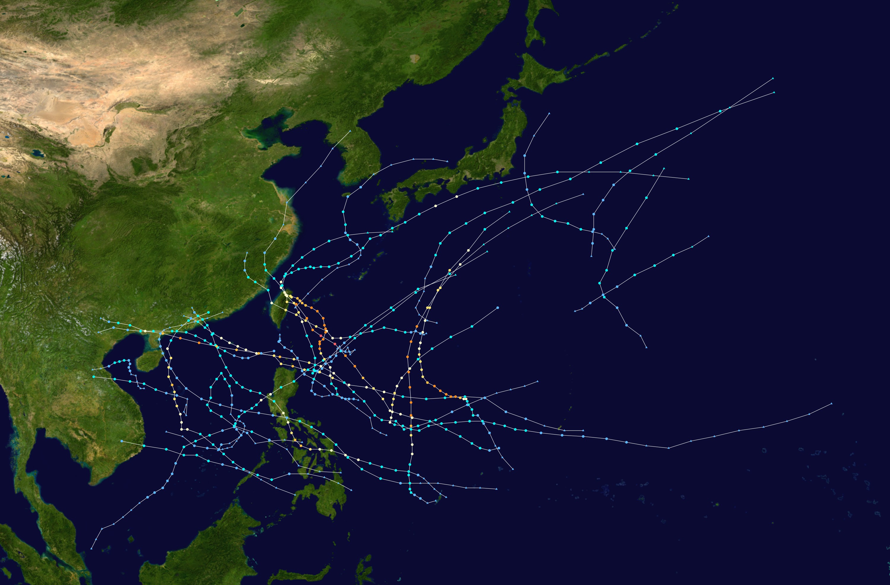
English: This map shows the tracks of all tropical cyclones in the 2008 Pacific typhoon season. The points show the location of each storm at 6-hour intervals. The colour represents the storm's maximum sustained wind speeds as classified in the Saffir-Simpson Hurricane Scale (see below), and the shape of the data points represent the type of the storm.
Tropical depression (≤38 mph, ≤62 km/h)
Tropical storm (39–73 mph, 63–118 km/h)
Category 1 (74–95 mph, 119–153 km/h)
Category 2 (96–110 mph, 154–177 km/h)
Category 3 (111–129 mph, 178–208 km/h)
Category 4 (130–156 mph, 209–251 km/h)
Category 5 (≥157 mph, ≥252 km/h)
Unknown
Storm type |
| Nguồn gốc | Created using Wikipedia:WikiProject Tropical cyclones/Tracks. The background image is from NASA [1]. The tracking data is from the Joint Typhoon Warning Center's best track database |
| Tác giả | Potapych |

|
This file may be updated to reflect new information. If you wish to use a specific version of the file without new updates being mirrored, please upload the required version as a separate file. |
| Tác phẩm này đã được tác giả của nó, Potapych, phát hành vào phạm vi công cộng. Điều này có hiệu lực trên toàn thế giới. Tại một quốc gia mà luật pháp không cho phép điều này, thì: Potapych cho phép tất cả mọi người được quyền sử dụng tác phẩm này với bất cứ mục đích nào, không kèm theo bất kỳ điều kiện nào, trừ phi luật pháp yêu cầu những điều kiện đó. |
Lịch sử tập tin
Nhấn vào ngày/giờ để xem nội dung tập tin tại thời điểm đó.
| Ngày/giờ | Hình xem trước | Kích cỡ | Thành viên | Miêu tả | |
|---|---|---|---|---|---|
| hiện tại | 21:55, ngày 17 tháng 4 năm 2009 | | 3.000×1.974 (698 kB) | Potapych | {{PD-user|Potapych}} * Background image from NASA * Position of dots from [http://metocph.nmci.navy.mil/jtwc/best_tracks/ JTWC] Category:Pacific typhoon season track maps [[Category:2008 Pacific typhoon se |
Trang sử dụng tập tin
Chưa có trang nào ở Wikipedia tiếng Việt liên kết đến tập tin này.
Sử dụng tập tin toàn cục
Những wiki sau đang sử dụng tập tin này:
- Trang sử dụng tại ko.wikipedia.org
- Trang sử dụng tại th.wikipedia.org