
Tập tin:Canada.A2002160.1920.721.250m.jpg
Kích thước hình xem trước: 712×600 điểm ảnh. Độ phân giải khác: 285×240 điểm ảnh | 570×480 điểm ảnh | 912×768 điểm ảnh | 1.216×1.024 điểm ảnh | 2.432×2.048 điểm ảnh | 2.914×2.454 điểm ảnh.
Tập tin gốc (2.914×2.454 điểm ảnh, kích thước tập tin: 1,82 MB, kiểu MIME: image/jpeg)
Tập tin này từ Wikimedia Commons. Trang miêu tả nó ở đấy được sao chép dưới đây. Commons là kho lưu trữ tập tin phương tiện có giấy phép tự do. Bạn có thể tham gia. |
Miêu tả
| Miêu tả |
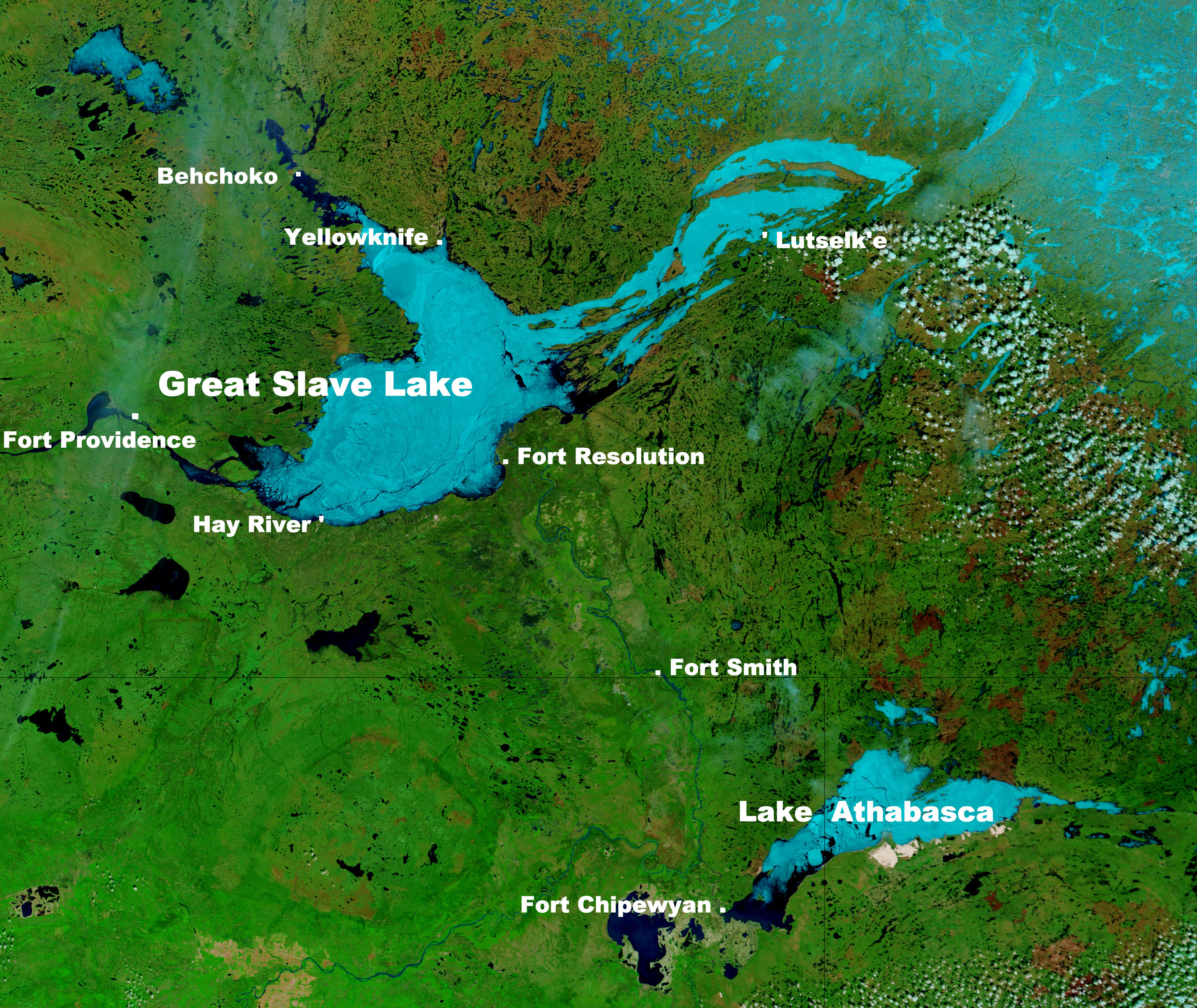
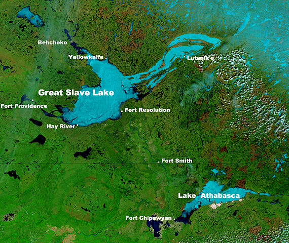
English: These true- and false-color images of central Canada show the Great Slave Lake in the Northwest Territories (top) and Lake Athabasca to the southeast. Lake Athabasca straddles the border between Alberta (west) and Saskatchewan (east). A fire (red dot) is burning in Alberta, and the snow capped Rocky Mountains cut through southwest Alberta at bottom left. In the false-color image, vegetation is green, water is dark blue, and ice (or snow) is light blue.
(Captions added by Kayoty) |
| Ngày | |
| Nguồn gốc | Nasa (Visible Earth) |
| Tác giả | Jacques Descloitres, MODIS Land Rapid Response Team, NASA/GSFC |
Giấy phép
| This file is in the public domain in the United States because it was solely created by NASA. NASA copyright policy states that "NASA material is not protected by copyright unless noted". (See Template:PD-USGov, NASA copyright policy page or JPL Image Use Policy.) | ||
 |
Warnings:
|
Lịch sử tập tin
Nhấn vào ngày/giờ để xem nội dung tập tin tại thời điểm đó.
| Ngày/giờ | Hình xem trước | Kích cỡ | Thành viên | Miêu tả | |
|---|---|---|---|---|---|
| hiện tại | 10:17, ngày 16 tháng 9 năm 2014 | | 2.914×2.454 (1,82 MB) | Kayoty | added Behchoko to map |
| 09:33, ngày 16 tháng 9 năm 2014 |  | 2.914×2.454 (1,82 MB) | Kayoty | User created page with UploadWizard |
Trang sử dụng tập tin
Có 1 trang tại Wikipedia tiếng Việt có liên kết đến tập tin (không hiển thị trang ở các dự án khác):
Sử dụng tập tin toàn cục
Những wiki sau đang sử dụng tập tin này:
- Trang sử dụng tại af.wikipedia.org
- Trang sử dụng tại bs.wikipedia.org
- Trang sử dụng tại en.wikipedia.org
- Trang sử dụng tại fa.wikipedia.org
- Trang sử dụng tại fr.wikipedia.org
- Trang sử dụng tại he.wikipedia.org
- Trang sử dụng tại id.wikipedia.org
- Trang sử dụng tại is.wikipedia.org
- Trang sử dụng tại kn.wikipedia.org
- Trang sử dụng tại la.wikipedia.org
- Trang sử dụng tại lv.wikipedia.org
- Trang sử dụng tại ml.wikipedia.org
- Trang sử dụng tại sl.wikipedia.org
- Trang sử dụng tại th.wikipedia.org
- Trang sử dụng tại vls.wikipedia.org
- Trang sử dụng tại xmf.wikipedia.org
- Trang sử dụng tại zh.wikipedia.org