
Tập tin:Dead-Sea---Salt-Evaporation-Ponds.jpg
Kích thước hình xem trước: 525×599 điểm ảnh. Độ phân giải khác: 210×240 điểm ảnh | 421×480 điểm ảnh | 673×768 điểm ảnh | 1.057×1.206 điểm ảnh.
Tập tin gốc (1.057×1.206 điểm ảnh, kích thước tập tin: 518 kB, kiểu MIME: image/jpeg)
Tập tin này từ Wikimedia Commons. Trang miêu tả nó ở đấy được sao chép dưới đây. Commons là kho lưu trữ tập tin phương tiện có giấy phép tự do. Bạn có thể tham gia. |
Miêu tả
| Miêu tả |
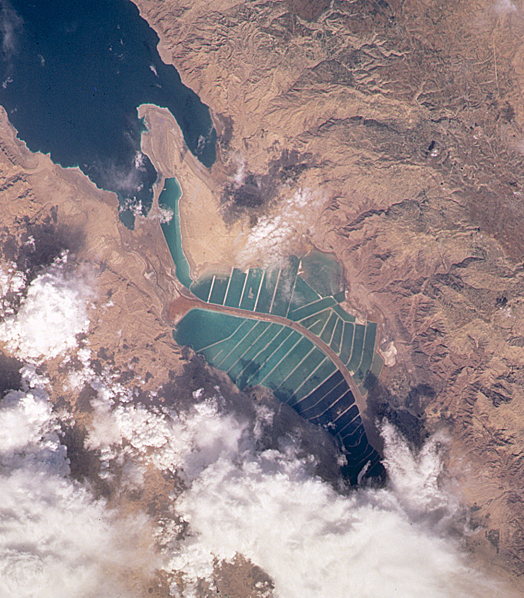
English: Orbital image of Jordanian and Israeli mineral evaporation ponds at the south end of the Dead Sea, separated by a central dike that runs roughly north-south along the international border. |
| Nguồn gốc | http://visibleearth.nasa.gov/cgi-bin/viewrecord?7875 |
| Tác giả | Image taken from the space shuttle by the STS102 crew in March 2001. |
Captioned As
| Page | Caption |
|---|---|
| Dead Sea | View of the mineral evaporation ponds almost 12 years later (STS-102). A northern and small southeastern extension were added and the large polygonal ponds subdivided. |
Giấy phép
| This file is in the public domain in the United States because it was solely created by NASA. NASA copyright policy states that "NASA material is not protected by copyright unless noted". (See Template:PD-USGov, NASA copyright policy page or JPL Image Use Policy.) | ||
 |
Warnings:
|
Nhật trình tải lên đầu tiên
Trang miêu tả gốc từng tồn tại ở đây. Tất cả các tên người dùng sau là tên người dùng tại en.wikipedia.
| Ngày/Giờ | Kích cỡ | Thành viên | Miêu tả |
|---|---|---|---|
| 2004-10-10 19:45 | 1057×1206× (530534 bytes) | Solipsist | Satelite image of [[Jordan]]ian salt evaporation ponds at the south end of the [[Dead Sea]] |
Lịch sử tập tin
Nhấn vào ngày/giờ để xem nội dung tập tin tại thời điểm đó.
| Ngày/giờ | Hình xem trước | Kích cỡ | Thành viên | Miêu tả | |
|---|---|---|---|---|---|
| hiện tại | 04:47, ngày 22 tháng 2 năm 2017 | | 1.057×1.206 (518 kB) | Ineuw | Transferred from en.wikipedia |
Trang sử dụng tập tin
Có 1 trang tại Wikipedia tiếng Việt có liên kết đến tập tin (không hiển thị trang ở các dự án khác):
Sử dụng tập tin toàn cục
Những wiki sau đang sử dụng tập tin này:
- Trang sử dụng tại en.wikipedia.org
- Trang sử dụng tại he.wikipedia.org
- Trang sử dụng tại id.wikipedia.org
- Trang sử dụng tại ru.wikipedia.org
- Trang sử dụng tại sl.wikipedia.org
- Trang sử dụng tại tr.wikipedia.org