
Tập tin:OxfordshireOxford.png
Không có độ phân giải cao hơn.
OxfordshireOxford.png (200×267 điểm ảnh, kích thước tập tin: 17 kB, kiểu MIME: image/png)
Tập tin này từ Wikimedia Commons. Trang miêu tả nó ở đấy được sao chép dưới đây. Commons là kho lưu trữ tập tin phương tiện có giấy phép tự do. Bạn có thể tham gia. |
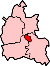
Oxford in Oxfordshire
Created by en:User:Morwen

|
Bạn có quyền sao chép, phân phối và/hoặc sửa đổi tài liệu này theo những điều khoản được quy định trong Giấy phép Tài liệu Tự do GNU, phiên bản 1.2 hoặc các phiên bản mới hơn được Quỹ Phần mềm Tự do; quy định; ngoại trừ những phần không được sửa đổi, bìa trước và bìa sau. Bạn có thể xem giấy phép nói trên ở phần Giấy phép Tài liệu Tự do GNU. |
| Tập tin này được phát hành theo Giấy phép Creative Commons Ghi công - Chia sẻ tương tự 3.0 Chưa chuyển đồi | ||
| ||
| Thẻ quyền này được thêm vào tập tin trong khi cập nhật giấy phép GFDL. |
Lịch sử tập tin
Nhấn vào ngày/giờ để xem nội dung tập tin tại thời điểm đó.
| Ngày/giờ | Hình xem trước | Kích cỡ | Thành viên | Miêu tả | |
|---|---|---|---|---|---|
| hiện tại | 09:55, ngày 27 tháng 9 năm 2005 | | 200×267 (17 kB) | Voyager | City of Oxford shown within Oxfordshire Map by en:User:Morwen Category:Maps of England |
Trang sử dụng tập tin
Chưa có trang nào ở Wikipedia tiếng Việt liên kết đến tập tin này.
Sử dụng tập tin toàn cục
Những wiki sau đang sử dụng tập tin này:
- Trang sử dụng tại azb.wikipedia.org
- Trang sử dụng tại en.wikipedia.org
- Oxford
- Iffley
- Marston, Oxford
- Cowley, Oxfordshire
- Wolvercote
- Oxford East (UK Parliament constituency)
- Oxford West and Abingdon (UK Parliament constituency)
- Littlemore
- Port Meadow, Oxford
- Headington
- Blackbird Leys
- Risinghurst
- Grandpont
- Oxford (UK Parliament constituency)
- Jericho, Oxford
- Risinghurst and Sandhills
- Oxford City Council elections
- North Oxford
- Park Town, Oxford
- New Marston
- Cutteslowe
- Binsey, Oxfordshire
- Godstow
- Headington Rural District
- Osney
- Summertown, Oxford
- St Clement's, Oxford
- Headington Hill
- Rose Hill, Oxfordshire
- New Hinksey
- Hinksey
- Sunnymead
- Barton, Oxfordshire
- Donnington, Oxfordshire
- St. Ebbes
- Oxfordshire (UK Parliament constituency)
- Walton Manor
- Norham Manor
- Oxpens Road
- Template:Oxford
- User:Rst20xx/Contributions and Awards
- St John Street area
- Holywell, Oxford
- Northway, Oxford
- Waterways, Oxford
- Wood Farm, Oxfordshire
Xem thêm các trang toàn cục sử dụng tập tin này.