
Tập tin:USACE Black Butte Dam and Lake.jpg

Kích thước hình xem trước: 800×526 điểm ảnh. Độ phân giải khác: 320×211 điểm ảnh | 640×421 điểm ảnh | 1.024×674 điểm ảnh | 1.500×987 điểm ảnh.
Tập tin gốc (1.500×987 điểm ảnh, kích thước tập tin: 619 kB, kiểu MIME: image/jpeg)
Tập tin này từ Wikimedia Commons. Trang miêu tả nó ở đấy được sao chép dưới đây. Commons là kho lưu trữ tập tin phương tiện có giấy phép tự do. Bạn có thể tham gia. |
| Miêu tả |
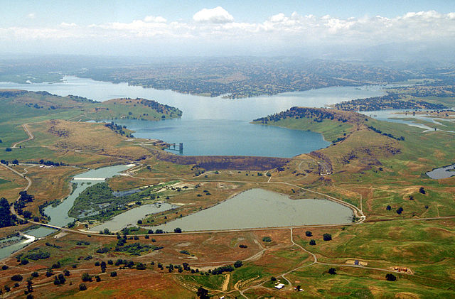
English: Aerial view of Black Butte Dam and Lake in Tehama County, California, USA. The dam was constructed in 1963 for flood control on Stony Creek. The dam is located approximately 9 miles (14.5 km) west of Orland, California.
Coordinates: 39°49′1.17″N 122°20′14.13″W / 39.8169917°N 122.3372583°W |
|||
| Vị trí | Tehama and Glenn Counties, California, USA | |||
| Ngày | not specified or unknown | |||
| Nguồn gốc |
U.S. Army Corps of Engineers Digital Visual Library Image page Image description page Digital Visual Library home page |
|||
| Tác giả | Michael Nevins, U.S. Army Corps of Engineers | |||
| Giấy phép (Dùng lại tập tin) |
|
Lịch sử tập tin
Nhấn vào ngày/giờ để xem nội dung tập tin tại thời điểm đó.
| Ngày/giờ | Hình xem trước | Kích cỡ | Thành viên | Miêu tả | |
|---|---|---|---|---|---|
| hiện tại | 05:47, ngày 5 tháng 5 năm 2007 | | 1.500×987 (619 kB) | DanMS | {{Information | Description = {{en|Aerial view of Black Butte Dam and Lake in Tehama County, California, USA. The dam was constructed in 1963 for flood control on Stony Creek. The dam is located approximately 9 miles (15.4 km) west of Orland, Californi |
Trang sử dụng tập tin
Có 2 trang tại Wikipedia tiếng Việt có liên kết đến tập tin (không hiển thị trang ở các dự án khác):
Sử dụng tập tin toàn cục
Những wiki sau đang sử dụng tập tin này:
- Trang sử dụng tại ar.wikipedia.org
- Trang sử dụng tại arz.wikipedia.org
- Trang sử dụng tại az.wikipedia.org
- Trang sử dụng tại ceb.wikipedia.org
- Trang sử dụng tại ce.wikipedia.org
- Trang sử dụng tại cs.wikipedia.org
- Trang sử dụng tại cy.wikipedia.org
- Trang sử dụng tại de.wikipedia.org
- Trang sử dụng tại en.wikipedia.org
- Trang sử dụng tại en.wikivoyage.org
- Trang sử dụng tại es.wikipedia.org
- Trang sử dụng tại ga.wikipedia.org
- Trang sử dụng tại hu.wikipedia.org
- Trang sử dụng tại hy.wikipedia.org
- Trang sử dụng tại no.wikipedia.org
- Trang sử dụng tại pl.wikipedia.org
- Trang sử dụng tại pt.wikipedia.org
- Trang sử dụng tại ru.wikipedia.org
- Trang sử dụng tại sr.wikipedia.org
- Trang sử dụng tại tr.wikipedia.org
- Trang sử dụng tại tt.wikipedia.org
- Trang sử dụng tại www.wikidata.org