
Tập tin:Woleai old map.png

Kích thước hình xem trước: 800×562 điểm ảnh. Độ phân giải khác: 320×225 điểm ảnh | 640×450 điểm ảnh | 1.024×719 điểm ảnh | 1.200×843 điểm ảnh.
Tập tin gốc (1.200×843 điểm ảnh, kích thước tập tin: 22 kB, kiểu MIME: image/png)
Tập tin này từ Wikimedia Commons. Trang miêu tả nó ở đấy được sao chép dưới đây. Commons là kho lưu trữ tập tin phương tiện có giấy phép tự do. Bạn có thể tham gia. |
Miêu tả
| Miêu tả |
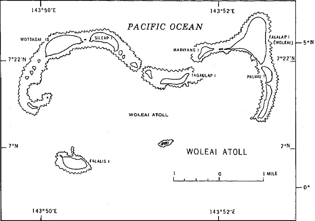
English: 1970 census of the (former) Trust Territory of the Pacific Islands (now Federated States of Micronesia, Palua, and Marshall Islands)
with several maps, including a map of Woleai Atoll, eastern Yap State |
| Ngày | |
| Nguồn gốc | http://www2.census.gov/prod2/decennial/documents/00496492v1p54-58ch5.pdf, page 8 |
| Tác giả | U.S. Bureau of the Census |
Giấy phép
This image or file is a work of a United States Census Bureau employee, taken or made as part of that person's official duties. As a work of the U.S. federal government, the image is in the public domain.
|
 |
Lịch sử tập tin
Nhấn vào ngày/giờ để xem nội dung tập tin tại thời điểm đó.
| Ngày/giờ | Hình xem trước | Kích cỡ | Thành viên | Miêu tả | |
|---|---|---|---|---|---|
| hiện tại | 16:50, ngày 10 tháng 1 năm 2010 | | 1.200×843 (22 kB) | Ratzer | {{Information |Description={{en|1=1970 census of the (former) Trust Territory of the Pacific Islands (now Federated States of Micronesia, Palua, and Marshall Islands) with several maps, including a map of Woleai Atoll, eastern Yap State}} |Source=http://w |
Trang sử dụng tập tin
Có 1 trang tại Wikipedia tiếng Việt có liên kết đến tập tin (không hiển thị trang ở các dự án khác):
Sử dụng tập tin toàn cục
Những wiki sau đang sử dụng tập tin này:
- Trang sử dụng tại en.wikipedia.org
- Trang sử dụng tại fa.wikipedia.org
- Trang sử dụng tại ja.wikipedia.org
- Trang sử dụng tại pl.wikipedia.org
- Trang sử dụng tại ru.wikipedia.org
- Trang sử dụng tại tr.wikipedia.org
- Trang sử dụng tại wuu.wikipedia.org
- Trang sử dụng tại zh.wikipedia.org