
Tập tin:GSLV Mk III M1, Chandrayaan-2 Lifting off 01.jpg
Kích thước hình xem trước: 800×532 điểm ảnh. Độ phân giải khác: 320×213 điểm ảnh | 640×426 điểm ảnh | 1.024×682 điểm ảnh | 1.280×852 điểm ảnh | 2.560×1.704 điểm ảnh | 4.928×3.280 điểm ảnh.
Tập tin gốc (4.928×3.280 điểm ảnh, kích thước tập tin: 2,53 MB, kiểu MIME: image/jpeg)
Tập tin này từ Wikimedia Commons. Trang miêu tả nó ở đấy được sao chép dưới đây. Commons là kho lưu trữ tập tin phương tiện có giấy phép tự do. Bạn có thể tham gia. |
Miêu tả
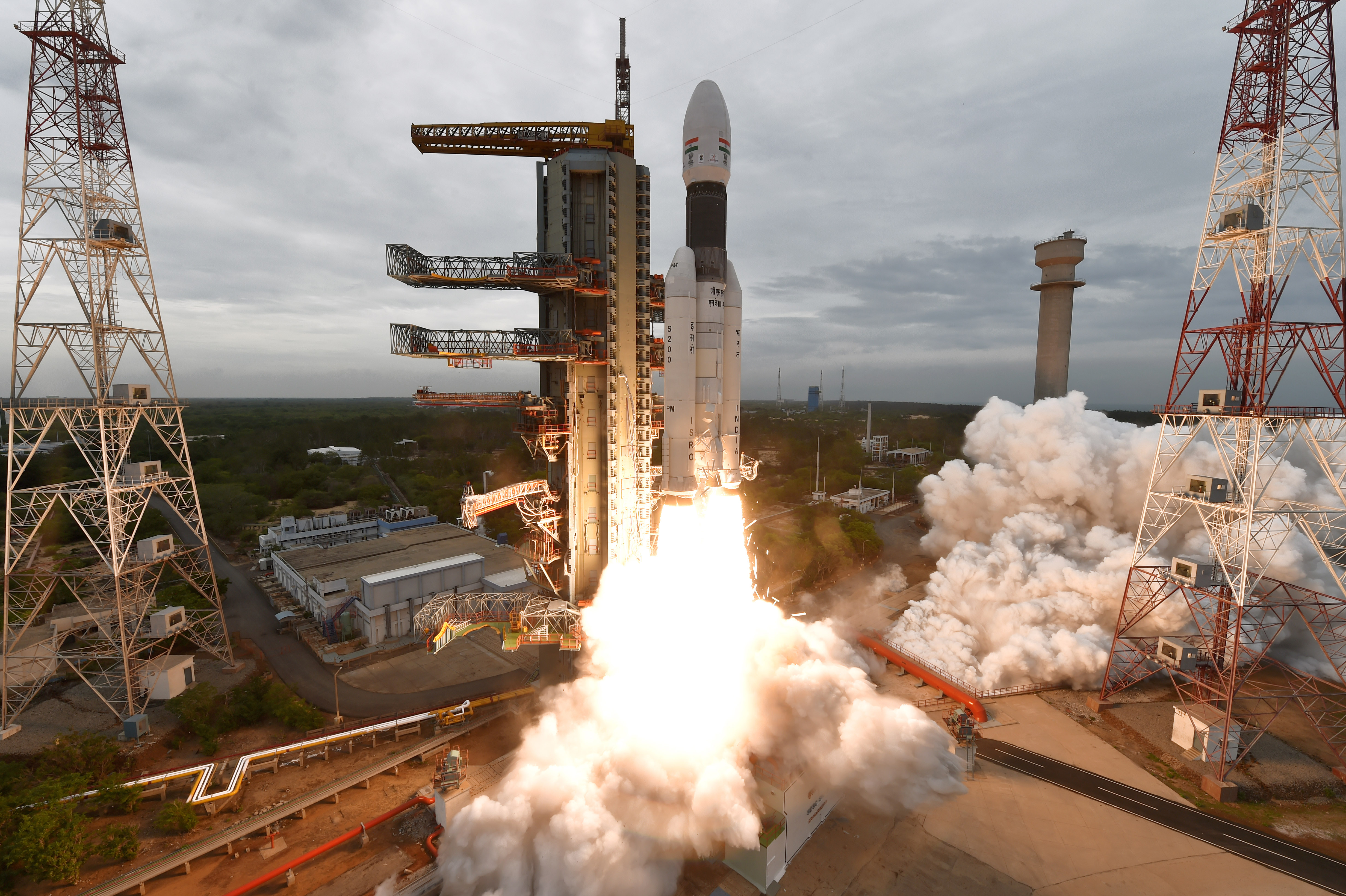
| Miêu tả | GSLV Mk III M1, Chandrayaan-2 Lifting off from second launch pad of SDSC SHAR |
| Ngày | |
| Nguồn gốc | https://www.isro.gov.in/chandrayaan2-gallery |
| Tác giả | Indian Space Research Organisation |
| Vị trí máy chụp hình | | Xem hình này và các hình ảnh lân cận trên: OpenStreetMap |
|---|
Giấy phép

|
This file is a copyrighted work of the Government of India, licensed under the Government Open Data License - India (GODL).
Information on Related Items:
|
 |
| Ghi công: Indian Space Research Organisation (GODL-India) | ||
|
|

|
This image, which was originally posted in the source indicated above, has not yet been reviewed by an administrator or reviewer to confirm that the above license is valid. See Category:Unreviewed photos of GODL-India for further instructions.
|
Lịch sử tập tin
Nhấn vào ngày/giờ để xem nội dung tập tin tại thời điểm đó.
| Ngày/giờ | Hình xem trước | Kích cỡ | Thành viên | Miêu tả | |
|---|---|---|---|---|---|
| hiện tại | 14:00, ngày 22 tháng 7 năm 2019 | | 4.928×3.280 (2,53 MB) | Ohsin | VicuñaUploader 1.23 |
Trang sử dụng tập tin
Có 1 trang tại Wikipedia tiếng Việt có liên kết đến tập tin (không hiển thị trang ở các dự án khác):
Sử dụng tập tin toàn cục
Những wiki sau đang sử dụng tập tin này:
- Trang sử dụng tại bh.wikipedia.org
- Trang sử dụng tại bn.wikipedia.org
- Trang sử dụng tại en.wikipedia.org
- Trang sử dụng tại fa.wikipedia.org
- Trang sử dụng tại fr.wikipedia.org
- Trang sử dụng tại gu.wikipedia.org
- Trang sử dụng tại hr.wikipedia.org
- Trang sử dụng tại kn.wikipedia.org
- Trang sử dụng tại mnw.wikipedia.org
- Trang sử dụng tại or.wikipedia.org
- Trang sử dụng tại ta.wikipedia.org
- Trang sử dụng tại te.wikipedia.org
- Trang sử dụng tại tr.wikipedia.org
- Trang sử dụng tại uk.wikipedia.org
- Trang sử dụng tại www.wikidata.org