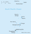
Tập tin:Tonga sm04.gif
Tonga_sm04.gif (359×386 điểm ảnh, kích thước tập tin: 6 kB, kiểu MIME: image/gif)
Lịch sử tập tin
Nhấn vào ngày/giờ để xem nội dung tập tin tại thời điểm đó.
| Ngày/giờ | Hình xem trước | Kích cỡ | Thành viên | Miêu tả | |
|---|---|---|---|---|---|
| hiện tại | 05:18, ngày 13 tháng 2 năm 2022 |  | 359×386 (6 kB) | Lojwe | Cropped 1 % horizontally, 1 % vertically using CropTool with precise mode. |
| 22:38, ngày 27 tháng 11 năm 2006 |  | 364×391 (7 kB) | Electionworld | {{ew|en|Tom Radulovich}} {{PD-USGov-CIA}} Category:Maps of Tonga |
Trang sử dụng tập tin
Chưa có trang nào ở Wikipedia tiếng Việt liên kết đến tập tin này.
Sử dụng tập tin toàn cục
Những wiki sau đang sử dụng tập tin này:
- Trang sử dụng tại be-tarask.wikipedia.org
- Trang sử dụng tại cs.wikipedia.org
- Trang sử dụng tại cy.wikipedia.org
- Trang sử dụng tại de.wikipedia.org
- Trang sử dụng tại en.wikipedia.org
- Trang sử dụng tại es.wikipedia.org
- Trang sử dụng tại fa.wikipedia.org
- Trang sử dụng tại fi.wikipedia.org
- Trang sử dụng tại fr.wikipedia.org
- Trang sử dụng tại gl.wikipedia.org
- Trang sử dụng tại id.wikipedia.org
- Trang sử dụng tại incubator.wikimedia.org
- Trang sử dụng tại io.wikipedia.org
- Trang sử dụng tại it.wikipedia.org
- Trang sử dụng tại ja.wikipedia.org
- Trang sử dụng tại jv.wikipedia.org
- Trang sử dụng tại ka.wikipedia.org
- Trang sử dụng tại ko.wikipedia.org
- Trang sử dụng tại ml.wikipedia.org
- Trang sử dụng tại mrj.wikipedia.org
- Trang sử dụng tại mr.wikipedia.org
- Trang sử dụng tại no.wikipedia.org
- Trang sử dụng tại pt.wikipedia.org
- Trang sử dụng tại ro.wikipedia.org
- Trang sử dụng tại ru.wikipedia.org
- Trang sử dụng tại sd.wikipedia.org
- Trang sử dụng tại simple.wikipedia.org
- Trang sử dụng tại sv.wikipedia.org
Xem thêm các trang toàn cục sử dụng tập tin này.


