
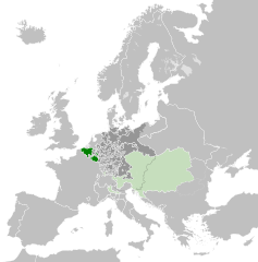
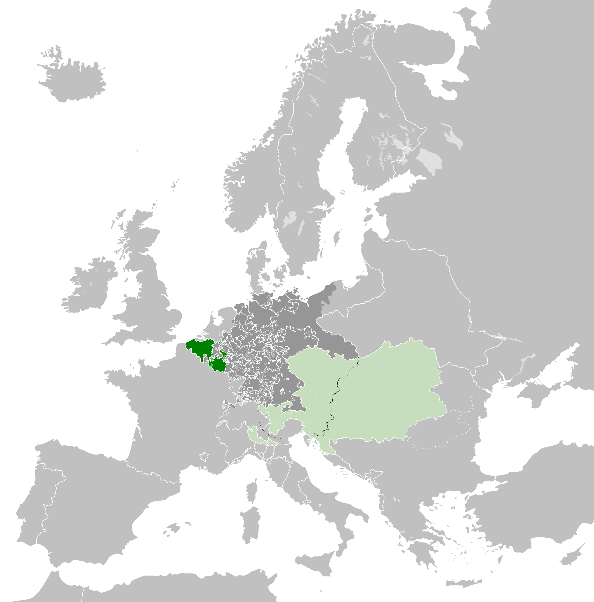
Tập tin:Austrian Netherlands 1789.svg

Kích thước bản xem trước PNG này của tập tin SVG: 450×456 điểm ảnh. Độ phân giải khác: 237×240 điểm ảnh | 474×480 điểm ảnh | 758×768 điểm ảnh | 1.011×1.024 điểm ảnh | 2.021×2.048 điểm ảnh.
Tập tin gốc (tập tin SVG, 450×456 điểm ảnh trên danh nghĩa, kích thước: 858 kB)
Tập tin này từ Wikimedia Commons. Trang miêu tả nó ở đấy được sao chép dưới đây. Commons là kho lưu trữ tập tin phương tiện có giấy phép tự do. Bạn có thể tham gia. |
Miêu tả


.svg)
.svg)
.svg)
.svg)
.svg)


.svg)
.svg)
.svg)


.png)
.png)


.svg)


.svg)

.svg)


.svg)
.svg)
.svg)
.svg)


.svg)
.png)


.svg)


.svg)
.svg)


.svg)


.svg)


.svg)
.svg)
.svg)
.svg)
.svg)
.svg)
.svg)
_cropped.svg)
.svg)
.svg)
.svg)
.svg)
.svg)
.svg)
.svg)
.svg)
.svg)
.svg)
.svg)
.svg)
.svg)
.svg)
.svg)
.svg)
.svg)
.svg)
.svg)
.svg)
.svg)
.svg)
.svg)
.svg)
.svg)
.svg)
.svg)
.svg)
.svg)
.svg)
.svg)
.svg)
.svg)
.svg)
.svg)
.svg)
.svg)
.svg)
.svg)
.svg)
.svg)
.svg)
.svg)
.svg)
.svg)
Giấy phép
Tôi, người giữ bản quyền tác phẩm này, từ đây phát hành nó theo giấy phép sau:
Tập tin này được phát hành theo Giấy phép Creative Commons Ghi công - Chia sẻ tương tự 3.0 Chưa chuyển đồi
- Bạn được phép:
- chia sẻ – sao chép, phân phối và chuyển giao tác phẩm
- pha trộn – để chuyển thể tác phẩm
- Theo các điều kiện sau:
- ghi công – Bạn phải ghi lại tác giả và nguồn, liên kết đến giấy phép, và các thay đổi đã được thực hiện, nếu có. Bạn có thể làm các điều trên bằng bất kỳ cách hợp lý nào, miễn sao không ám chỉ rằng người cho giấy phép ủng hộ bạn hay việc sử dụng của bạn.
- chia sẻ tương tự – Nếu bạn biến tấu, biến đổi, hoặc làm tác phẩm khác dựa trên tác phẩm này, bạn chỉ được phép phân phối tác phẩm mới theo giấy phép y hệt hoặc tương thích với tác phẩm gốc.
Nhật trình tải lên đầu tiên
This image is a derivative work of the following images:
- File:Europe_1789.svg licensed with Cc-by-sa-3.0
- 2013-04-14T03:44:26Z Alphathon 450x456 (858577 Bytes) Corrected some errors in northern Italy
- 2013-04-14T01:38:01Z Alphathon 450x456 (853881 Bytes) tweaked again
- 2013-04-14T01:36:10Z Alphathon 450x456 (853881 Bytes) Tweaked Holy Roman Empire border style
- 2013-04-14T01:33:26Z Alphathon 450x456 (853857 Bytes) == {{int:filedesc}} == {{Information |Description={{en|A blank Map of Europe circa 1789. This map also includes a border for the [[:en:Holy Roman Empire|Holy Roman Empire]]. Since there are so many small German states, they h
Uploaded with derivativeFX
Lịch sử tập tin
Nhấn vào ngày/giờ để xem nội dung tập tin tại thời điểm đó.
| Ngày/giờ | Hình xem trước | Kích cỡ | Thành viên | Miêu tả | |
|---|---|---|---|---|---|
| hiện tại | 07:38, ngày 17 tháng 10 năm 2021 | | 450×456 (858 kB) | Fenn-O-maniC | Wrong file |
| 07:38, ngày 17 tháng 10 năm 2021 |  | 450×456 (800 kB) | Fenn-O-maniC | Fixed the Russo-Swedish border to match the Treaty of Åbo of 1743 | |
| 07:36, ngày 17 tháng 10 năm 2021 |  | 450×456 (858 kB) | Fenn-O-maniC | Fixed the Russo-Swedish border to match the Treaty of Åbo of 1743 | |
| 20:34, ngày 18 tháng 4 năm 2013 |  | 450×456 (878 kB) | Alphathon | Style change | |
| 18:34, ngày 18 tháng 4 năm 2013 |  | 450×456 (857 kB) | Alphathon | Various fixes | |
| 20:31, ngày 15 tháng 4 năm 2013 |  | 450×456 (854 kB) | Alphathon | Corrected Scandinavian borders | |
| 23:18, ngày 14 tháng 4 năm 2013 |  | 450×456 (839 kB) | Alphathon | Changed colour of the remainder of the Habsburg Monarchy | |
| 13:29, ngày 14 tháng 4 năm 2013 |  | 450×456 (839 kB) | Alphathon | == {{int:filedesc}} == {{Information |Description={{en|A map of the Austrian Netherlands within the Habsburg Monarchy, the Holy Roman Empire and Europe circa 1789.}}{{de|Eine Landkarte die [[:de:Öste... |
Trang sử dụng tập tin
Có 2 trang tại Wikipedia tiếng Việt có liên kết đến tập tin (không hiển thị trang ở các dự án khác):
Sử dụng tập tin toàn cục
Những wiki sau đang sử dụng tập tin này:
- Trang sử dụng tại ar.wikipedia.org
- Trang sử dụng tại ast.wikipedia.org
- Trang sử dụng tại bg.wikipedia.org
- Trang sử dụng tại cs.wikipedia.org
- Trang sử dụng tại en.wikipedia.org
- Trang sử dụng tại eo.wikipedia.org
- Trang sử dụng tại et.wikipedia.org
- Trang sử dụng tại eu.wikipedia.org
- Trang sử dụng tại fa.wikipedia.org
- Trang sử dụng tại fi.wikipedia.org
- Trang sử dụng tại fr.wikipedia.org
- Trang sử dụng tại gl.wikipedia.org
- Trang sử dụng tại he.wikipedia.org
- Trang sử dụng tại id.wikipedia.org
- Trang sử dụng tại is.wikipedia.org
- Trang sử dụng tại it.wikipedia.org
- Trang sử dụng tại ja.wikipedia.org
- Trang sử dụng tại ko.wikipedia.org
- Trang sử dụng tại lv.wikipedia.org
- Trang sử dụng tại mk.wikipedia.org
- Trang sử dụng tại pt.wikipedia.org
- Trang sử dụng tại sl.wikipedia.org
- Trang sử dụng tại th.wikipedia.org
- Trang sử dụng tại tr.wikipedia.org
- Trang sử dụng tại uk.wikipedia.org
- Trang sử dụng tại www.wikidata.org
- Trang sử dụng tại zh.wikipedia.org