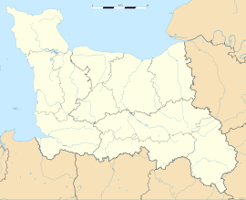
Tournebu
Bách khoa toàn thư mở Wikipedia
|
Tournebu | |
| Hành chính | |
|---|---|
| Quốc gia | |
| Vùng | Normandie |
| Tỉnh | Calvados |
| Quận | Caen |
| Tổng | Thury-Harcourt |
| Liên xã | Communauté de communes de la Suisse Normande |
| Xã (thị) trưởng | Jean Vanryckeghem (2008-2014) |
| Thống kê | |
| Độ cao | 109–188 m (358–617 ft) (bình quân 150 m (490 ft)[chuyển đổi: tùy chọn không hợp lệ]) |
| Diện tích đất1 | 11,4 km2 (4,4 dặm vuông Anh) |
| INSEE/Mã bưu chính | 14703/ 14220 |
Tournebu là một xã ở tỉnh Calvados, thuộc vùng Normandie ở tây bắc nước Pháp.
Dân số[sửa | sửa mã nguồn]
| Năm | 1962 | 1968 | 1975 | 1982 | 1990 | 1999 |
|---|---|---|---|---|---|---|
| Dân số | 289 | 297 | 286 | 276 | 309 | 295 |
| From the year 1962 on: No double counting—residents of multiple communes (e.g. students and military personnel) are counted only once. | ||||||
Xem thêm[sửa | sửa mã nguồn]
Tham khảo[sửa | sửa mã nguồn]
Liên kết ngoài[sửa | sửa mã nguồn]
- Tournebu sur le site de l'Institut géographique national Lưu trữ 2007-03-12 tại Wayback Machine
- Tournebu sur le site de l'Insee[liên kết hỏng]
- Tournebu sur le site du Quid Lưu trữ 2007-09-30 tại Wayback Machine
- Localisation de Tournebu sur une carte de France et communes limitrophes[liên kết hỏng]
- Plan de Tournebu sur Mapquest


